UPC clock estimation collection is now available!

211 views

The GREAT measurement of gravitational red shift allowed an improvement of a factor of 6 in a 40-year-old result of great relevance for general relativity. Now, a new data product of the project is available here from the GSSC:  1 year of continuous clock data using a new algorithm developed by gAGE/UPC under a contract funded by ESA’s Navigation Science Office. It is believed this new data may allow further better statistical characterizations of the gravitational redshift.

Having cracked the problem and achieved such a remarkable result with the original GREAT measurement (one week of data available here, the full dataset upon request), also allowed the scientists involved to understand how this estimation could be further improved. One of the constraints of the GREAT previous data were the small discontinuities introduced in the clock data every 24 hours by the processing algorithms

With this new work by gAGE/UPC, this problem has now been overcome. Long-term satellite clock series of about one year, from January 2nd to December 16th of 2017, have been estimated for all GPS and Galileo satellites, including the two eccentric Galileo satellites. Some of the main characteristics of this new approach are 1) the use of unambiguous carrier phases, 2) processing several constellations and several frequencies and 3) considering the temperature dependency of the phase biases.

Figure 1: The new approach is compared with the GFZ and ESOC clock estimations

Our results (see Figure 1) show the removal of clock data day-boundary discontinuities, which we believe may benefit the statistical characterization of long-term phenomena correlated with the on-board clocks, such as the measurement of the Gravitational redshift with Galileo eccentric satellites.

Reference:

[1] “Removing day-boundary discontinuities on GNSS clock estimates: methodology and results”, Adria Rovira‑Garcia, Jose Miguel Juan, Jaume Sanz, Guillermo Gonzalez‑Casado, Javier Ventura‑Traveset, Luigi Cacciapuoti and Erik Schoenemann. Journal on GPS Solutions, January 2021. https://link.springer.com/article/10.1007/s10291-021-01085-3

CAMALIOT Project kick-offs successfully achieved

180 views

GNSS infrastructure has been growing significantly in recent years. In the space segment, four global constellations are operational, including the European Galileo system. On ground, tens of thousands of permanent GNSS stations are continuously recording data. In addition, millions of Internet-of-things (IoT) devices, including smartphones, use GNSS for positioning. Due to the large number of devices, IoT data offers great potential for GNSS science exploitations, with unprecedented spatio-temporal resolution. However, exploitation of IoT data for GNSS science purposes is currently limited due to multiple challenges.

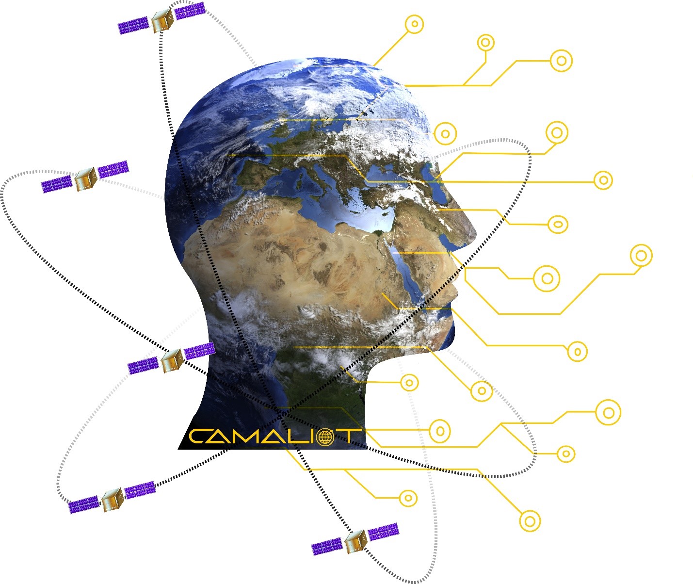
To address these challenges, CAMALIOT “Application of Machine Learning Technology for GNSS IoT Data Fusion” will integrate IoT and traditional GNSS data sources leveraging on Big Data, Data Fusion and Machine Learning (ML) technologies to unleash innovation opportunities in GNSS science fields. CAMALIOT will extend current capabilities of the GNSS Science Support Centre (GSSC) , with IoT-enabled GNSS data processing pipelines to support several use cases.

Two parallel contracts have been launched to achieve CAMALIOT’s objectives:

Use Cases

By using an Agile approach, the consortium will develop such software infrastructure as an extension of the current GSSC architecture by focusing on its functional System Domains. The final architecture will extend the current GSSC in the fields of data ingestion, processing and analysis services by implementing the IoT components (including crowdsourcing app) and the ML models and pipeline. The validation of the system domain is conducted through different test cases, mainly focused on the selected GNSS Science use cases.

The consortium will develop an Android app for the collection of raw GNSS data from smartphones. A crowdsourcing campaign will be launched, based on the concept of citizen science. In order to cope with the large amounts of GNSS data of heterogeneous quality, new processing methods will be developed that are highly automated and robust. For this purpose, specific ML algorithms will be designed, trained, and applied. Based on the GNSS results, two scientific use cases will be studied, the first focusing on the determination of tropospheric parameters to support weather forecasts on Earth, and the second one concerning the monitoring of space weather, important for satellite operations and communication.

GNSS for crisis

200 views

As the measures of the lockdown, due to the COVID-19 pandemic, are starting to slow down and society is getting ready for the recovery and the ‘return to routine’, the GNSS response is becoming increasingly important.

During the past two months, several GNSS-Galileo-based cell-phone apps have been launched to try to head off the pandemic spread. These initiatives are capable of tracking geolocation and mobility of infected people, detecting which city zones pose a high contagion risk and help users to connect up to the emergency healthcare system. For example, the satnav-based location tool is able to monitor the spread of the disease. Other apps help citizens decide whether or not they have coronavirus-compatible symptoms, feeding back instructions and recommendations on the basis of the assessed results.

These apps have been used for tracking and thereby facilitating resources that will help both government authorities and individuals to curb the coronavirus spread.

However, satellite navigation goes one step further and some apps have the purpose to meet some of society’s needs after the lockdown. It is the case of the initiatives that look to alert people with the aim of keeping the safety distance in places such as supermarkets or pharmacies where there could be higher risk of contagion.

In support of these news challenges generated by the post lockdown situation, ESA’s Galileo navigation Science Office is also encouraging some internal initiatives, like the future launch of a dedicated “COVID-19 space hunting platform”, to be integrated as part of the GSSC services, to support on-going COVID research initiatives, notably those where geolocation is of relevance, that may cope with some society needs.

As stated on the ESA’s article, ESA’s partner agency the GSA, European Global Navigation Satellite System Agency, working with the assistance of the European Commission, has put together a list of the mentioned apps that are already giving a response and will help the citizens from now on. Most of the apps that are on the list are already helping people and can be found in app stores.

Thanks to the GNSS response, society will have greater access to COVID-19 information, staving off the collapse of hospitals and health centers under heavy demand and preventing the possible new outbreaks once measures are weakened.

GNSS Science 7th Colloquium: Proceedings now available

155 views

Last September, the 7th GNSS Science colloquium brought together several members of the European scientific community and their international partners involved in the use of Galileo and other GNSS satellites.

The objective of this congress was to review the various possibilities of using satellites for scientific purposes and take stock of the current advances achieved under this program.

The conference was organised as a series of plenary talks, parallel half day sessions and poster presentations throughout the event. This edition counted with near 200 participants from 25 countries and a total of 134 scientific contributions, covering a large variety of scientific domains.

ESA’s GNSS Science Support Centre (GSSC) made various presentations dealing with, among other matters, GNSS Big Data. Big Data from Space refers to earth and space observation data collated from ground and space sensors, as well as other space dominions like satellite navigation. The colloquium was a success.

We are pleased to announce that the colloquium Proceedings are now available via the GNSS Science Support Centre’s website.

Source of the picture: GSSC ESA website.

CubeSat finds its way in space with Galileo receiver

131 views

An ETH Zurich mission, supported by ESA, has used Galileo to obtain position and timing fixes in orbit for the first time. This low-cost mission intends to demonstrate the in-orbit capabilities of Galileo, paving way for future navigation and scientific experiments.

The CubeSat, assembled by Astrocast, contains a navigation payload of four GNSS receivers and two GNSS antennas. The receivers are mass-market u-blox multi-constellation receivers intended for ground applications modified for the orbital environment, as opposed to the usual high-cost space-grade receivers. This low-cost platform has achieved positioning accuracy of five metres, as reported at the 7th GNSS Colloquium in Zurich.

GNSS is widely used by satellites in low-Earth orbit for guidance, navigation and control. The combined use of Galileo with GPS and other GNSS constellations improves the accuracy and resilience of the positioning system, which has advantages for the precise orbit determination of the satellite. This, in turn, has an impact on overall mission performance. For example, for next generation Copernicus Earth-observation satellites, this could lead to more accurate environmental data.

This mission, conceived by ESA’s GNSS Science Advisory Committee and funded by ESA’s European GNSS Evolution Programme, could pave way to extending the use of CubeSats to perform future experiments to test European navigation systems and their evolutions, in partnership with other universities and research institutions.

For further information, refer to:
http://www.esa.int/Applications/Navigation/CubeSat_finds_its_way_in_space_with_Galileo_receiver

7th International Colloquium on Scientific and Fundamental Aspects of GNSS

99 views

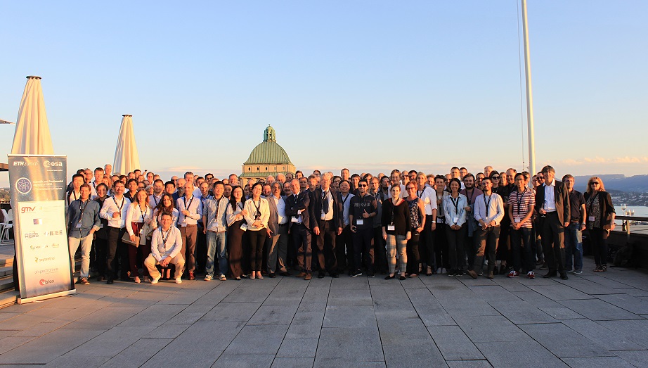
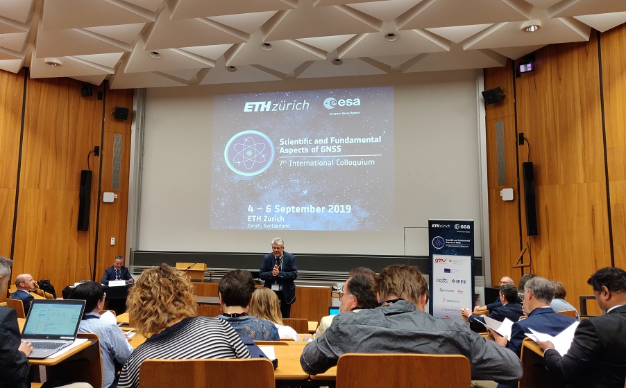
The seventh edition of the International Colloquium on Scientific and Fundamental Aspects of GNSS was held in Zurich from 4 to 6 September 2019 with a great scientific return across several fields.

Colloquium_group

The Colloquium, organised by ESA biannually since 2007 across different locations in Europe, was hosted by ETH Zurich in this occasion. The purpose of the Colloquium is to encourage the multidisciplinary field of GNSS science and to contribute to the development of GNSS evolutions. The conference was praised for the highly innovative ideas presented by the scientific community, including around 200 participants from 25 different countries (not only from ESA home countries, but also from other organisations like NASA), and for the successful organisation of the event.

Interest in GNSS science is growing in many fields, such as fundamental physics, geophysics, space research and atmospheric studies. Around 90 oral presentations and 42 posters proved this interest.

From the field of fundamental physics, there were two dedicated sessions exploring GNSS as a research tool for advanced topics such as Relativity and Dark Matter. Applications of GNSS to seismology and other geophysics topics were also covered by the conference.

colloquium_presentation

As for space research, there were dedicated sessions seeking service volume applications, including LEO orbit and time, lunar exploration and other missions. There was also a specific session on experimental payloads for scientific use on next generation GNSS, such as VLBI transmitters or Gamma Ray Burst detectors.

Atmospheric studies were also largely covered at the conference, with several sessions presenting studies on the application of GNSS to troposphere, ionosphere and meteorological phenomena. One of the highlights of the Colloquium was a dedicated panel on GNSS for Climate Change, with world-wide experts on the subject. Several presentations on applications of GNSS reflectometry also highlighted its growing interest for applications such as ice and water level monitoring.

There were also sessions to provide state-of-the-art studies on Precise Orbit Determination, timing, metrology and GNSS precise positioning techniques, especially the impact of multi-constellation observations.

The GNSS Science Support Centre was also present at the Colloquium, with the status of its development presented during the GNSS infrastructure session.

In order to collect some of the presented innovations, a special issue of the Advances in Space Research journal shall be produced with papers from the Colloquium. Authors are invited to submit papers by 31 January 2020.

Galileo Satellite Metadata updated by the GSA

116 views

The European GNSS Service Centre (GSC) web portal has published updated Galileo satellite metadata.

The European GNSS Service Centre (GSC) web portal has published updated Galileo satellite metadata. This metadata includes satellite properties used for advanced GNSS processing algorithms and other fields of space engineering.

The satellite metadata includes the mass and centre of mass for each spacecraft, the Antenna Reference Point (ARP) and Phase Centre Offsets for all Galileo signals (E1, E5a, E5b and E6), the Laser Retro Reflector location (LRR), group delay, and geometrical specifications of the Galileo constellation satellites.

The use of this metadata allows scientists and engineers to improve the accuracy of models used for high performance applications, such as Precise Point Positioning (PPP), which computes centimetre-level accuracy positions for GNSS users, or Precise Orbit Determination (POD). The fact that the information is publicly available simplifies these activities, which would otherwise require a significant effort to reverse-engineer the metadata from raw measurements.

The metadata update also includes previously unavailable information for the satellites launched most recently, namely L9 in December 2017 and L10 in July 2018, which are now fully described.

The GSA runs the European GNSS Service Centre (GSC) as an interface between the Galileo system and the users of Galileo Open Service and Commercial Service, supporting added value services enabled by Galileo. It is located at the National Institute of Aerospace Technologies (INTA) facilities near Madrid, Spain. Besides the metadata, the GSC web portal also provides information on many other technical subjects related to the Galileo system, such as orbital parameters, system status, Notice Advisory to Galileo Users, performance reports and reference documentation.

The original source of this article is the European GNSS Agency (GSA). Further information may be found on GSC website:
https://www.gsc-europa.eu/news/galileo-satellite-metadata-updated

PULCHRON, a Pulsar timescale demonstration

141 views

Pulsars are magnetised spinning neutron stars that emit a beam of electromagnetic radiation along their magnetic axis (see an artist impression in fig. 1). Depending on their alignment, to an observer on Earth they may look like a beacon emitted by a lighthouse. Because of their compact size, of the order of 10Km, these objects rotate very fast with typical periods of less than a couple of seconds. Although the pulses emitted by a pulsar can be quite irregular and show a very clear deceleration trend, a class of pulsars with periods of the order of milliseconds and extremely stable pulses over periods of the order of billions of years has been identified. The details behind the mechanism involved in the formation of these so-called millisecond pulsars are still not completely understood, but it is suspected they are formed in binary systems when an old pulsar with very little of its rotational energy left, starts accreting large amounts of mass from its companion star. The accreted mass will thus transfer angular momentum to the neutron star, therefore “recycling” the pulsar and giving rise to a very stable rotation that can continue for billions of years. Millisecond pulsars are so stable that at some point it was believed they could compete for accuracy with the most accurate clocks on Earth. With the advance of clock technology this is no longer true (fig 2) but, fortunately for us, that is not the end of the story regarding the use of pulsars as clocks.

The use of pulsars as clocks still has some benefits:

  • As they are completely independent from terrestrial clocks, they can be used as a check on conventional timescales;
  • As opposed to atomic clocks whose principles of operation rely on quantum mechanics, pulsar clocks are based on astrophysics processes on stellar mass objects;
  • Unlike atomic clocks whose useful lifetime hardly exceeds 10 years, pulsar clocks will continue to operate for millions to billions of years and they could therefore be used for navigation far from the earth.

Pulsar timescales are therefore still worth investigating and that is the goal of PULCHRON, a project funded by NAVISP involving a partnership between GMV, the University of Manchester (UoM) and ESA.

Stability range for a range of different sources including pulsars and laboratory clocks. (from Hartnett and Luiten, Rev. Mod. Phys., 83 (2011) 1-9)

Pulsar observations performed by 5 European radio telescopes participating in the European Pulsar Timing Array (EPTA) and provided by UoM, allow the PULCHRON team to investigate how to build a stable timescale combining pulsar data with conventional timescales, such as UTC.

Using the time of arrival (ToA) of the pulsar signal, frequencies and drifts for each pulsar are calculated with a model that takes into account pulsar physics, propagation of the signal in the interstellar medium and antenna characteristics. Once the frequencies are known, the PULCHRON team calculates the timing residuals, the differences between the ToAs and the values predicted by the model, for each pulsar.

With the pulsar characteristics and the timing residuals, PULCHRON will then investigate both the implementation of a physical timescale (using the pulsar data to steer the output of an hydrogen maser) and the construction of a composite time scale (using the pulsar timescale and satellite and ground based clocks). The first will demonstrate the feasibility of using a pulsar timescale to monitor a “conventional” clock, in this case an hydrogen maser. The second will investigate the generation of a timescale combining both the short term stability of earth bound atomic clocks and the long term availability and stability of pulsars.

Although PULCHRON has been running for less than 6 months, the results are already extremely encouraging and show how it is possible to explore the synergies between two apparently unconnected fields: astrophysics and navigation.

Once the project ends, before the end of September, the data will be available from the GSSC site.

Call for Ideas for GNSS Evolutions

126 views

The European Space Agency (ESA) has launched a Call for Ideas for GNSS evolutions novel on-board atomic clock technologies, experimental scientific payloads, and science activities. An Invitation-To-Tender launched by ESA’s Directorate of Navigation under the EU Research and Innovation Framework Programme H2020, aims to develop technology and foster research in three categories related to the European GNSS programmes, namely Galileo and EGNOS.

The Experimental Payloads category groups the development of innovative, non-navigation payloads for future satellites of the Galileo constellation, which include optical payloads for ranging and communications or various instruments for space environment, space weather and remote sensing supporting atmospheric science. The purpose of this category is to provide added value services to the Galileo system. Subsystem-level prototyping and testing are expected activities as proof-of-concept.

The second category comprises studies of state-of-the-art technologies for Galileo on-board atomic clocks. The goal is to identify future on-board clock technologies.

The third category includes scientific studies taking advantage of the specific features and capabilities of Galileo and EGNOS programmes for highly innovative research in areas such as Fundamental Physics, Earth and Atmospheric Sciences or Metrology. From the scientific point of view, Galileo has features useful for scientific research such as the triple-frequency signals, absolute antenna calibration, accurate attitude, stable orbits and dissemination of accurate timing information. Some examples from past studies include the ‘Galileo gravitational Redshift Experiment with eccentric sATellites’ (GREAT) and ‘Galileo AltBOC signal exploitation for Synthetic Aperture Radar imaging’.

Potential applicants are invited to find out more here: http://emits.sso.esa.int/emits/owa/emits_online.showao?typ1=7939&user=Anonymous.

ESA/JRC International Summer School on GNSS 2019

120 views

The ESA/JRC International Summer School on GNSS 2019 will be held in Vila Nova de Cerveira, in the north of Portugal, from 15 to 26 July.

Organised by the European Space Agency (ESA) and the Joint Research Centre (JRC), with the collaboration of Oporto University and several external sponsors, the school represents a unique chance for young satellite-navigation researchers to get all the latest high-level information from renowned worldwide scientists and specialists, like the Director of the Galileo Programme and Navigation-Related Activities (D/NAV), Paul Verhoef.

The programme is open to postgraduate students, PhD candidates, early-stage researchers and young engineers and professionals keen to broaden their knowledge.

The objective of this Summer School is to give an overview of satellite navigation, exploring the theoretical bases of the Global Navigation Satellite System GNSS, its signals, the processing carried out by signal receivers and, finally, determining the position-navigation-time (PNT) solution. As well as hands-on workshops, giving a realistic idea of the work carried out in this area, lectures will be held on intellectual property rights and patents while some business aspects will also be dealt with.

Throughout the week attendees will also have the chance of talking about the future of satellite-navigation systems and set up a group business project based on a ground-breaking idea, taking into account the product or service business plan, its technical performance and, finally, its marketing to end clients. All this in an incomparable venue, in the district of Viana do Castelo near the River Minho on the Portuguese border with Spain.

To find out more:
https://www.esa-jrc-summerschool.org/